
Wetland Delineation
Professional wetland boundary identification, field flagging, GPS mapping, and project planning support for Florida properties.
Professional Wetland Delineation Services in Florida
Wetland delineation is the process of identifying and marking the boundary between wetland and upland areas on a property. In Florida, wetlands and other surface waters can affect land development, building location, site design, permitting requirements, and the amount of usable upland area available for a project.
Bear Environmental Consulting provides professional wetland delineation services for property owners, buyers, builders, developers, contractors, engineers, real estate professionals, and land managers throughout Florida. Our work helps clients understand where wetlands may occur and how those features may affect future planning, permitting, or construction.
When a Wetland Delineation May Be Needed
A wetland delineation may be appropriate before:
Purchasing vacant or undeveloped land
Designing a home, driveway, commercial site, subdivision, or access road
Clearing, grading, or filling land
Applying for building, development, or environmental permits
Responding to county, municipal, state, or federal review comments
Determining whether wetlands may affect the usable area of a property
Evaluating whether a project can avoid wetland impacts
Preparing wetland impact exhibits or mitigation plans
Coordinating with engineers, surveyors, planners, or agencies
Wetland delineation is often one of the first steps in determining how environmental constraints may affect a project.
What a Wetland Delineation Includes
The exact scope depends on the property, site conditions, and project needs. A wetland delineation may include:
desktop review of aerial imagery, soils, land cover, and wetland mapping resources
field review of vegetation, soils, hydrology, and site conditions
identification of potential wetland and upland areas
flagging of wetland boundaries in the field
GPS mapping of the delineated wetland line
representative site photographs
preparation of a wetland delineation summary or report
GIS-based wetland location map or exhibit
coordination with the project team regarding next steps
If a survey-grade wetland line is needed for design or permitting, the flagged wetland boundary may also need to be located by a professional land surveyor.
How Wetlands Are Identified
Wetland delineation generally involves evaluating three primary indicators:
-
Wetland areas often contain plant species that are adapted to wet or saturated soil conditions. The presence, dominance, and distribution of wetland-associated vegetation can help determine whether an area meets wetland criteria.
-
Wetland soils often show characteristics associated with long-term saturation, such as hydric soil indicators. Soil evaluation can help confirm whether wetland conditions are present, especially in areas where vegetation or hydrology is less obvious.
-
Wetland hydrology refers to evidence that water is present at or near the surface for long enough to support wetland conditions. Indicators may include water marks, saturation, drift deposits, drainage patterns, oxidized root channels, or other signs of seasonal or periodic wetness.
These indicators are evaluated together to help determine the wetland-upland boundary.
Wetland Delineation and Permitting
A wetland delineation does not automatically authorize impacts to wetlands or surface waters. Instead, it helps define where wetland boundaries are located so the project team can determine whether impacts can be avoided, minimized, or whether permitting may be required.
Wetland delineation results may be used to support:
Site design and layout decisions
Avoidance and minimization planning
Wetland impact calculations
Environmental resource permit applications
Local government development review
Agency coordination
Mitigation planning
Construction limit planning
Survey and engineering plans
If the proposed project will impact wetlands or other surface waters, wetland permitting and mitigation assistance may be needed.
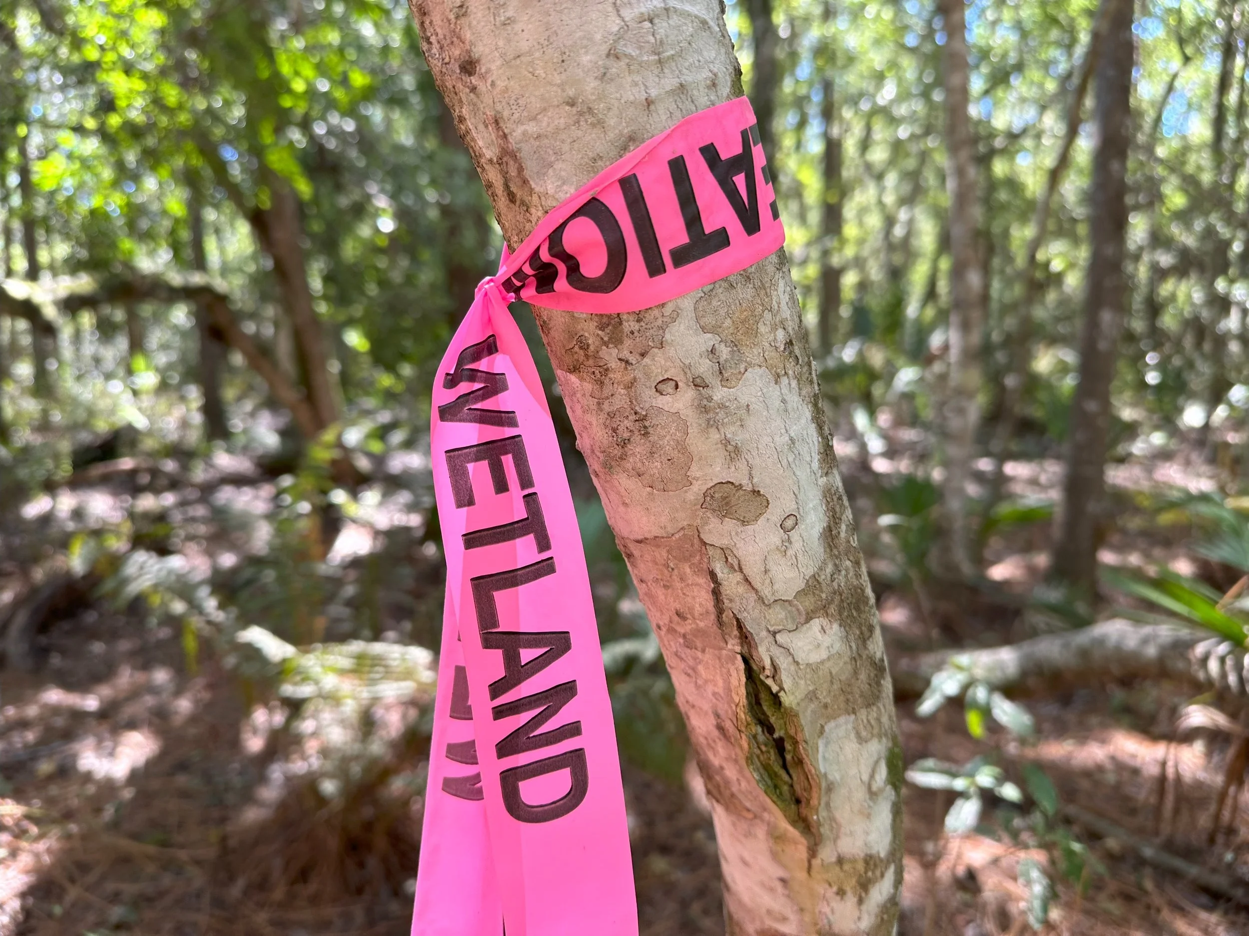
Field Flagging, GPS Mapping, and Survey Coordination
Wetland boundaries are commonly marked in the field using flagging tape or other markers. Once flagged, the wetland line can be GPS-mapped for planning purposes or located by a professional land surveyor when survey-grade accuracy is needed.
For many projects, the wetland line may need to be shown on a site plan, boundary survey, engineering plan, or permit exhibit. Bear Environmental Consulting can coordinate with the project team to help determine the appropriate level of mapping and documentation.
Common next steps may include:
GPS mapping of the flagged wetland line
Preparation of an approximate wetland exhibit
Coordination with a professional surveyor
Survey location of wetland flags
Wetland impact calculations
Preparation of wetland permitting exhibits
Why Wetland Delineation Matters
Wetlands can affect the layout, feasibility, cost, and timeline of a project. Without a wetland delineation, a property owner or project team may not know where wetland boundaries are located or whether the proposed work could require environmental permitting.
A wetland delineation can help answer important questions such as:
Are wetlands or surface waters present on the property?
Where is the boundary between wetland and upland areas?
How much usable upland area may be available?
Can the project be designed to avoid wetland impacts?
Will wetland permitting likely be required?
Could mitigation be needed?
Should the wetland line be surveyed?
Are additional environmental services recommended?
Identifying wetland boundaries early can help avoid redesign, delays, enforcement concerns, and unexpected permitting issues.
Common Projects That Need Wetland Delineation
Wetland delineation services are commonly requested for:
Single-family residential lots
Vacant land purchases
Commercial development
Subdivision planning
Driveway or access road construction
Utility corridors
Stormwater pond planning
Agricultural or land management projects
Shoreline or waterfront properties
Fill placement or grading projects
Mitigation or restoration projects
Agency or county review comments
If you are unsure whether wetlands may affect your property, an initial desktop review or field assessment can help determine whether a formal wetland delineation is recommended.
What You Receive
Depending on the project scope, deliverables may include:
Flagged wetland boundary in the field
GPS wetland line data
Wetland delineation summary or report
Wetland location map or GIS exhibit
Aerial map showing approximate wetland limits
Site photographs
Notes on wetland and upland conditions
Recommendations for permitting or next steps
Coordination with surveyors, engineers, or project teams
The specific deliverables depend on the project needs, site conditions, and intended use of the delineation.
Important Limitations
A wetland delineation identifies wetland boundaries based on observed site conditions and applicable methods at the time of the field review. Site conditions, hydrology, vegetation, and regulatory requirements may change over time.
A wetland delineation by itself does not authorize wetland impacts, filling, clearing, excavation, construction, or other regulated activities. If impacts to wetlands or other surface waters are proposed, appropriate permits or agency coordination may be required before work begins.
Formal agency verification may also be needed when a wetland boundary will be used for permitting, development approval, or regulatory certainty.
Related Services
Depending on the project, Bear Environmental Consulting may also assist with:
Need a Wetland Delineation?
Contact Bear Environmental Consulting before purchasing, clearing, designing, or developing your property. Provide the property address, parcel ID, county, and a brief description of the proposed work, and we can help determine the appropriate wetland delineation scope.