
Environmental mapping, spatial analysis, and report-ready GIS exhibits for Florida properties, surveys, permitting, and project planning.
GIS Mapping & Analysis
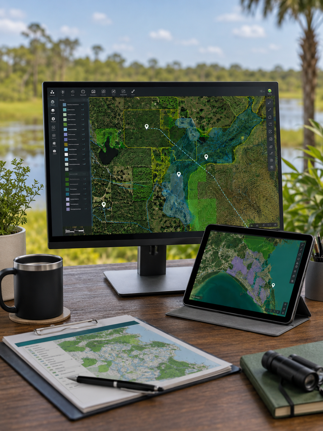
Environmental Mapping and Spatial Analysis for Florida Projects
Clear, accurate maps are an important part of environmental consulting, land development planning, permitting, and project communication. GIS mapping can help property owners and project teams understand site conditions, environmental constraints, survey results, wetland boundaries, protected species locations, land cover types, and proposed project impacts.
Bear Environmental Consulting provides GIS mapping and analysis services for property owners, developers, builders, contractors, engineers, planners, real estate professionals, land managers, and project teams throughout Florida. Our GIS services support environmental assessments, wetland delineations, protected species surveys, permitting, monitoring, and project planning.
When GIS Mapping & Analysis May Be Needed
GIS mapping and analysis may be useful when you need to:
evaluate environmental constraints on a property
map wetland boundaries or surface waters
document gopher tortoise burrows or protected species observations
prepare exhibits for reports, proposals, or permits
review land use and land cover conditions
compare current and historical aerial imagery
evaluate habitat conditions or site suitability
identify nearby conservation lands or sensitive resources
calculate approximate acreage or impact areas
communicate project limits, buffers, or avoidance areas
support wetland, wildlife, or regulatory assessments
provide clear visual information to clients, agencies, engineers, or contractors
GIS mapping can help turn complex site information into clear visuals that are easier to understand and use.
GIS Services We Provide
Depending on the project, Bear Environmental Consulting can assist with:
Property location maps
Aerial imagery exhibits
Wetland boundary maps
Surface water and drainage feature maps
Protected species observation maps
Gopher tortoise burrow maps
Burrowing owl burrow maps
Nest, cavity, or wildlife feature maps
Land use and land cover mapping
Habitat mapping
Soil and topographic review exhibits
Environmental constraints maps
Project impact maps
Buffer and avoidance area exhibits
Conservation area or preserve maps
Monitoring photo-location maps
Permit and report figures
GIS-based acreage calculations
Field data collection and GPS mapping support
The scope can be tailored depending on whether the map is for internal planning, client communication, report documentation, or agency coordination.
Environmental Assessments and Due Diligence Mapping
GIS mapping is especially useful during environmental assessments and property due diligence. A map can help identify potential constraints before a client purchases, clears, or develops a property.
Environmental assessment mapping may include:
property boundary and location exhibits
aerial imagery review
nearby wetland and surface water mapping
soil data review
floodplain or elevation review
land cover and habitat mapping
protected species consultation area review
conservation land proximity review
potential environmental constraints mapping
recommended field review areas
These maps can help clients better understand what may be present on a property and whether additional field review may be recommended.
Wetland and Surface Water Mapping
Wetland-related projects often require clear mapping to support planning, permitting, and communication with engineers or agencies. GIS mapping can help show where wetlands are located, how they relate to proposed work areas, and whether impacts may occur.
Wetland mapping may include:
approximate wetland boundary exhibits
GPS-mapped wetland flag lines
surveyor-coordinated wetland line exhibits
wetland impact maps
surface water feature maps
wetland buffer exhibits
mitigation or restoration area maps
monitoring area maps
agency or permit support figures
For formal design or permitting purposes, a survey-grade wetland line may need to be located by a professional land surveyor. GIS exhibits can still provide valuable planning-level information and visual support.
Protected Species and Wildlife Mapping
Protected species surveys often rely on accurate spatial documentation. GIS mapping can help show where wildlife observations, burrows, nests, cavities, buffers, or avoidance areas occur relative to proposed work.
Protected species mapping may include:
gopher tortoise burrow maps
burrowing owl burrow maps
active nest or cavity location maps
protected species observation maps
survey transect or coverage exhibits
avoidance area or buffer maps
relocation or monitoring maps
construction compliance exhibits
wildlife habitat or land cover maps
These maps can help project teams understand where sensitive resources occur and how those locations may affect clearing, construction, permitting, or monitoring.
Land Use, Land Cover, and Habitat Analysis
Land use and land cover analysis can help describe existing site conditions and support environmental assessments, protected species evaluations, mitigation planning, restoration planning, and permitting.
This may include review or mapping of:
upland and wetland habitat types
developed, disturbed, agricultural, or natural areas
pine flatwoods, scrub, pasture, forest, wetlands, or open lands
potential gopher tortoise habitat
potential burrowing owl habitat
potential foraging habitat for nesting birds or listed species
land cover changes over time
surrounding land use and habitat context
Land cover mapping can be especially useful when reports need to explain existing conditions clearly or when project teams need to understand environmental constraints across a property.
Field Data Collection and GPS Mapping
GIS mapping is often connected to field data collection. Bear Environmental Consulting can collect GPS points, lines, and polygons during fieldwork and use that information to prepare maps and exhibits.
Field-mapped features may include:
wetland flags
gopher tortoise burrows
burrowing owl burrows
active nests or wildlife features
photo locations
monitoring points
invasive plant observations
fence lines or protection measures
construction limits or avoidance areas
restoration planting zones
conservation or management areas
Field data can then be used to prepare report figures, permit exhibits, monitoring maps, or project planning documents.
Permit, Report, and Client Exhibits
Maps are often one of the most useful parts of an environmental report or permit package. A clear exhibit can help clients, contractors, engineers, and agency reviewers quickly understand where important features are located.
GIS exhibits may be used for:
environmental assessment reports
wetland delineation reports
gopher tortoise survey reports
burrowing owl survey reports
migratory bird nest evaluations
wetland permit applications
protected species permit support
mitigation or restoration plans
monitoring reports
construction compliance documentation
client presentations or project planning
Maps can be prepared in formats appropriate for reports, PDFs, printed exhibits, or digital project coordination.
What You May Receive
Depending on the project scope, GIS deliverables may include:
PDF map exhibits
report-ready figures
aerial imagery maps
property location maps
wetland boundary or impact maps
protected species observation maps
land cover or habitat maps
buffer or avoidance area exhibits
monitoring photo-location maps
GIS-based acreage calculations
shapefiles, KMZ/KML files, or other digital data, when requested
maps formatted for agency submittals, reports, or client review
The specific deliverables depend on the project needs, data availability, accuracy requirements, and intended use.
Important Limitations
GIS mapping and analysis depends on the accuracy, scale, age, and availability of source data. Public datasets, aerial imagery, property boundaries, wetland maps, soil maps, floodplain layers, and conservation data may not always reflect current or field-verified conditions.
GIS maps prepared for planning or environmental review purposes should not be treated as boundary surveys, engineering plans, legal determinations, or agency-approved jurisdictional limits unless specifically verified through the appropriate process. When survey-grade accuracy is required, coordination with a licensed professional land surveyor may be needed.
Field verification, wetland delineation, protected species surveys, or agency review may be recommended when decisions depend on precise site conditions.
Related Services
Depending on the project, Bear Environmental Consulting may also assist with:
Need GIS Mapping or Environmental Analysis for Your Project?
Contact Bear Environmental Consulting to discuss your property, project goals, and mapping needs. We can help prepare clear, practical GIS exhibits and spatial analysis to support environmental review, planning, permitting, or project communication.